


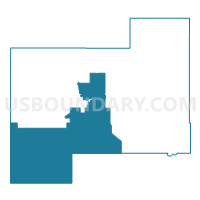
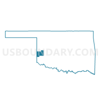
Voting District 115, Beckham County, Oklahoma
About
Outline

Summary
| Unique Area Identifier | 653510 |
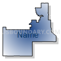
| Name | Voting District 115 |
| County | Beckham County |
| State | Oklahoma |
| Area (square miles) | 244.06 |
| Land Area (square miles) | 243.90 |
| Water Area (square miles) | 0.16 |
| % of Land Area | 99.93 |
| % of Water Area | 0.07 |
| Latitude of the Internal Point | 35.15326020 |
| Longtitude of the Internal Point | -99.80923130 |
Maps

Graphs
Select a template below for downloading or customizing gragh for Voting District 115, Beckham County, Oklahoma


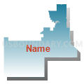
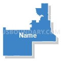


Neighbors
Neighoring Voting District (by Name) Neighboring Voting District on the Map
- Voting District 0009, Wheeler County, TX
- Voting District 0201, Collingsworth County, TX
- Voting District 101, Harmon County, OK
- Voting District 110, Beckham County, OK
- Voting District 112, Beckham County, OK
- Voting District 242, Beckham County, OK
- Voting District 302, Greer County, OK
- Voting District 320, Beckham County, OK
- Voting District 332, Beckham County, OK
- Voting District 343, Beckham County, OK
Top 10 Neighboring County Subdivision (by Population) Neighboring County Subdivision on the Map
- Sayre CCD, Beckham County, OK (5,321)
- Hollis CCD, Harmon County, OK (2,510)
- Shamrock CCD, Wheeler County, TX (2,432)
- Erick CCD, Beckham County, OK (1,756)
- Northwest Greer CCD, Greer County, OK (261)
- Samnorwood CCD, Collingsworth County, TX (190)
Top 10 Neighboring Place (by Population) Neighboring Place on the Map
Top 10 Neighboring Unified School District (by Population) Neighboring Unified School District on the Map
- Sayre Public Schools, OK (5,520)
- Mangum Public Schools, OK (3,583)
- Hollis Public Schools, OK (2,891)
- Shamrock Independent School District, TX (2,437)
- Erick Public Schools, OK (1,454)
- Samnorwood Independent School District, TX (176)
Top 10 Neighboring State Legislative District Lower Chamber (by Population) Neighboring State Legislative District Lower Chamber on the Map
Top 10 Neighboring State Legislative District Upper Chamber (by Population) Neighboring State Legislative District Upper Chamber on the Map
- State Senate District 28, TX (704,340)
- State Senate District 38, OK (70,224)
- State Senate District 26, OK (69,504)
Top 10 Neighboring 111th Congressional District (by Population) Neighboring 111th Congressional District on the Map
Top 10 Neighboring Census Tract (by Population) Neighboring Census Tract on the Map
- Census Tract 9668, Beckham County, OK (5,993)
- Census Tract 9503, Collingsworth County, TX (3,057)
- Census Tract 9678, Harmon County, OK (2,922)
- Census Tract 9671, Greer County, OK (2,626)
- Census Tract 9503, Wheeler County, TX (2,432)
- Census Tract 9665, Beckham County, OK (1,756)
Top 10 Neighboring 5-Digit ZIP Code Tabulation Area (by Population) Neighboring 5-Digit ZIP Code Tabulation Area on the Map
- 73662, OK (6,093)
- 73554, OK (3,614)
- 79095, TX (2,686)
- 79079, TX (2,646)
- 73645, OK (1,538)
- 73571, OK (87)